AI & ML Models
0.0 (0 reviews) • 0 downloads
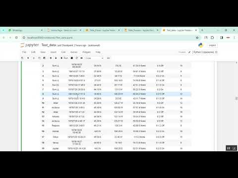
Celestial Navigation in Python Projects
र 1000
Celestial Navigation in Python Projects
Technical Details
Domain : Python
Database : Sqlite
Tools : Anaconda
Run Tools: VS Code
Database : Sqlite
Tools : Anaconda
Run Tools: VS Code
Secure Payment
Instant Download
GST Invoice
24/7 Support
About This Product
Celestial Navigation in Python Projects
Abstract
Celestial navigation is a traditional navigation technique that uses the positions of celestial bodies such as the Sun, Moon, planets, and stars to determine one’s geographic location on Earth. Although modern GPS technology dominates navigation today, celestial navigation remains essential as a reliable backup system for maritime travel, aviation, and space missions. This project presents a Celestial Navigation System using Python, which calculates an observer’s latitude and longitude based on celestial observations. The system uses astronomical algorithms, spherical trigonometry, and time conversions to process data such as altitude angles, declination, and Greenwich Hour Angle (GHA) from known celestial bodies. Python libraries like NumPy, Pandas, Math, and AstroPy are used to perform mathematical calculations and astronomical conversions. This project helps students, researchers, and navigation enthusiasts understand and simulate celestial navigation using programming.
Existing System
The existing celestial navigation techniques rely heavily on manual calculations, nautical almanacs, and sextants for measuring celestial altitudes. These traditional methods are time-consuming and involve complex mathematical tables and astronomical computations. Navigators must refer to printed almanacs and apply multiple corrections such as dip, refraction, and parallax to determine position accurately. Errors are common due to human calculation limitations. Though some digital navigation tools exist, many are either commercial, expensive, or not customizable for educational and research purposes. There is a lack of simple, Python-based computational tools for learning and applying celestial navigation principles.
Proposed System
The proposed system introduces a Python-based Celestial Navigation Calculator that automates position fixing using celestial observations. The user inputs the observed altitude of a celestial body, time of observation, and approximate geographical position. The system fetches celestial coordinates such as declination and GHA using astronomical algorithms or external data sources. Using spherical trigonometry and sight reduction techniques, the system calculates the line of position (LOP) and final estimated position. Corrections for atmospheric refraction, dip, and instrument error are automatically applied. The system may also visualize celestial position lines using Matplotlib for better understanding. This automated approach eliminates manual complexity, improves accuracy, and offers an educational tool for learning celestial navigation through Python programming.
Abstract
Celestial navigation is a traditional navigation technique that uses the positions of celestial bodies such as the Sun, Moon, planets, and stars to determine one’s geographic location on Earth. Although modern GPS technology dominates navigation today, celestial navigation remains essential as a reliable backup system for maritime travel, aviation, and space missions. This project presents a Celestial Navigation System using Python, which calculates an observer’s latitude and longitude based on celestial observations. The system uses astronomical algorithms, spherical trigonometry, and time conversions to process data such as altitude angles, declination, and Greenwich Hour Angle (GHA) from known celestial bodies. Python libraries like NumPy, Pandas, Math, and AstroPy are used to perform mathematical calculations and astronomical conversions. This project helps students, researchers, and navigation enthusiasts understand and simulate celestial navigation using programming.
Existing System
The existing celestial navigation techniques rely heavily on manual calculations, nautical almanacs, and sextants for measuring celestial altitudes. These traditional methods are time-consuming and involve complex mathematical tables and astronomical computations. Navigators must refer to printed almanacs and apply multiple corrections such as dip, refraction, and parallax to determine position accurately. Errors are common due to human calculation limitations. Though some digital navigation tools exist, many are either commercial, expensive, or not customizable for educational and research purposes. There is a lack of simple, Python-based computational tools for learning and applying celestial navigation principles.
Proposed System
The proposed system introduces a Python-based Celestial Navigation Calculator that automates position fixing using celestial observations. The user inputs the observed altitude of a celestial body, time of observation, and approximate geographical position. The system fetches celestial coordinates such as declination and GHA using astronomical algorithms or external data sources. Using spherical trigonometry and sight reduction techniques, the system calculates the line of position (LOP) and final estimated position. Corrections for atmospheric refraction, dip, and instrument error are automatically applied. The system may also visualize celestial position lines using Matplotlib for better understanding. This automated approach eliminates manual complexity, improves accuracy, and offers an educational tool for learning celestial navigation through Python programming.
Customer Reviews (0)
No reviews yet. Be the first!
Related Products
⭐ Featured
AI & ML Models
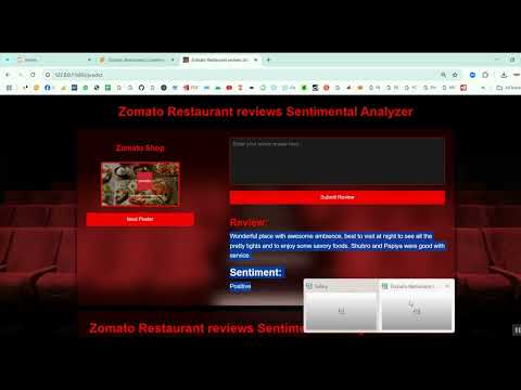
Zomato Restaurant Reviews Sentimental Analyzer in Python Projects
Zomato Restaurant Reviews Sentimental Analyzer in Python Projects
र 1000
⭐ Featured
⭐ Featured
AI & ML Models
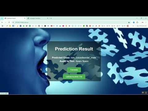
Voice Disorder Prediction using Audio Dataset in Python Projects
Voice Disorder Prediction using Audio Dataset in Python Projects
र 1000
AI & ML Models
Vitamin Deficiency Detection Using Image Processing in Python Projects
Vitamin Deficiency Detection Using Image Processing in Python Projects
र 1000